You can check the index under ‘sidebars’ to find these fascinating snapshots of history. A timeline of this historic era is found in the 'front section.' Boaters will also appreciate the extensive updates, re-writes, and new material found in the Waggoner Cruising Guide. In addition to the countless text updates, more than half of the 225 reference maps have been revised and an additional 16 new detailed reference maps have been added to the 2018 edition. Boaters can look forward to visiting many of the marinas who have made improvements and added moorage space as reported in the Waggoner Cruising Guide, in addition to new anchorages included in this year’s edition. The ‘front section’ of the guidebook, which includes ‘how-to’ material such as navigation, anchoring, weather and communications, has also been expanded. You will find helpful information about ELCI-protected shore-power now found at many marinas, along with helpful tips regarding how to establish a successful connection. Other articles in the front section include Potable Water, Chartering, and Maintenance to name a few. The Waggoner Cruising Guide continues to be “The Bible for Northwest Cruising,” providing all the necessary information for planning and preparing one’s personal voyage of adventure.
LLCruise2017.blogspot.com
Lorena and Leonard, Managing Editors of the Waggoner Guide, 2017 cruise to Northern British Columbia
Monday, November 13, 2017
What’s New in the 2018 Waggoner Cruising Guide?
You can check the index under ‘sidebars’ to find these fascinating snapshots of history. A timeline of this historic era is found in the 'front section.' Boaters will also appreciate the extensive updates, re-writes, and new material found in the Waggoner Cruising Guide. In addition to the countless text updates, more than half of the 225 reference maps have been revised and an additional 16 new detailed reference maps have been added to the 2018 edition. Boaters can look forward to visiting many of the marinas who have made improvements and added moorage space as reported in the Waggoner Cruising Guide, in addition to new anchorages included in this year’s edition. The ‘front section’ of the guidebook, which includes ‘how-to’ material such as navigation, anchoring, weather and communications, has also been expanded. You will find helpful information about ELCI-protected shore-power now found at many marinas, along with helpful tips regarding how to establish a successful connection. Other articles in the front section include Potable Water, Chartering, and Maintenance to name a few. The Waggoner Cruising Guide continues to be “The Bible for Northwest Cruising,” providing all the necessary information for planning and preparing one’s personal voyage of adventure.
Monday, September 4, 2017
Making of the Waggoner Cruising Guide
Combining pleasure with business can be intense while boating, but the real work begins when the collected data for the Waggoner Guide is organized, written, and assembled over the following months. Edited text, new additions, re-writes and boating articles are entered into Dropbox, a secure file for collaborative work, storage, and sharing. Photos related to each chapter or location are also posted in Dropbox. A separate file is kept for changes and updates to reference maps and newly created maps for marinas and anchorages found throughout this comprehensive guidebook. After the editors have made their changes for each chapter, our layout staff works with the ‘InDesign’ program, arranging the various pieces for each page, including the placement of ads, photos, and text blocks. A pdf of each chapter in the guidebook is created for the editors’ review; and the process starts again with additional changes, edits, and revisions. This process continues for two or more iterations, until all proof-reading and edits have been completed, and advertising space has been filled. Untold hours go into creating this complete 500-page cruising guidebook for boaters, which includes over 1,000 destination entries. A labor of love, the Waggoner Team works into the wee-hours of the night, 7-days a week for several months to meet the printing deadline. The completed file for the guidebook is sent off to the printers, who send back a proof before rolling the presses. A final review is made for color, placement, paging, registration marks etc. Any last-minute changes for edits or ads are noted as replacement pages which are communicated to the printer. After giving the final go-ahead for the presses to roll, it’s a big sigh of relief, followed by a happy celebration! Then it’s back to work in preparation for the Seattle Boat Show, where we reap the rewards of our efforts through smiling faces and comradery with active, friendly boaters.
Monday, August 28, 2017
Steveston Rediscovered
Quaint fishing village of Steveston and Harbour Authority Docks |
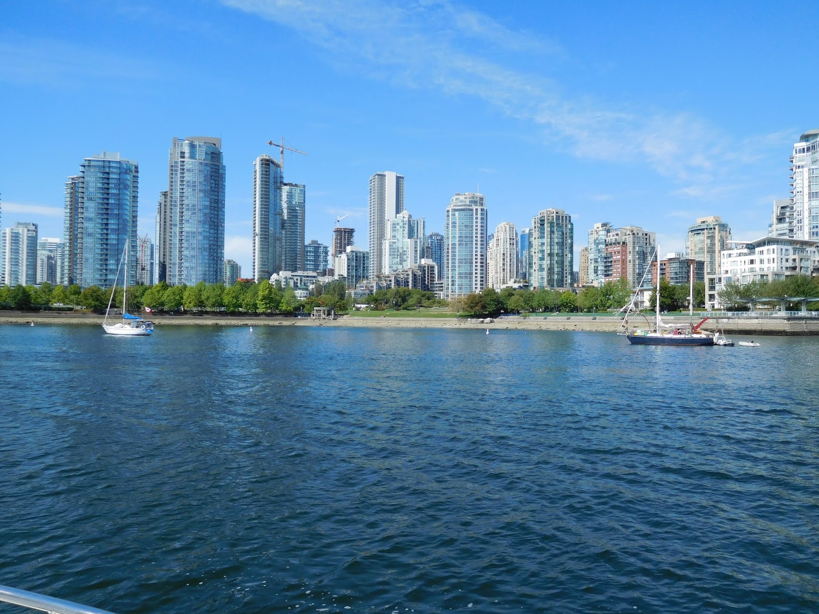
After a few days editing for
the Waggoner Guide and other computer work, we departed North Vancouver for
Steveston, rounding Point Grey in a northwesterly wind with 4-foot swells. Numerous commercial and sport fishing boats
were off-shore near the North, Middle, and South Arms of the Fraser River. Winding our way through the fishing fleet, we
turned east and followed the marked channel along the Steveston Jetty and
entered this charming fishing community.
Steveston looks like a movie set with its prominent wharf filled with
shops and eateries, and is a delightful place to visit possesing historic significance. The community was named in honor of Manoah
Steves, who arrived here with his family around 1877. It was his son William who developed the
townsite, becoming Steveston in 1889. Today
Steveston is one of several communities within the City of Richmond. Salmon canning began here in 1871 and by the
late 1800’s, there were 15 canneries operating along the Steveston waterfront.
The historic Britannia Shipyard |
Shipyard with Chinese Bunkhouse in distance |
Homes on pilings connect to a main boardwalk at the old cannery site |
The Murakami Home and Boatworks building |
The new City of Richmond 'Imperial Landing' facility |
A wide promonade with new condos extends between Steveston village and the National Historic Site |
Interesting Shopping at Steveston Harbour Authority Wharf |
Good eateries are found on the Wharf and in the Village |
Friday, August 25, 2017
‘Day Tripper’
Mosquito Creek Marina in
North Vancouver served us well as a base of operations for a planned day-trip
to Indian Arm. A local’s favorite
cruising ground, Indian Arm is one of the most scenic areas in Greater
Vancouver. The Coast Range Mountains
rise 5,000 feet over the inlet. From
Vancouver Harbour, we passed through the ‘Second Narrows’ along an industrial
area; but once we turned the corner northward up Indian Arm, we found a scenic
playground.
The Village of Deep Cove in Indian Arm |
Nice eateries and shops are found in Deep Cove |
Deep Cove Public Wharf and Deep Cove Yacht Club |
Future generation taking kayak lessons at Deep Cove |
Deep Cove Yacht Club with North Shore Marina in the distance |
Views from Deep Cove North Shore Marina |
One home we spotted near Lone Point has an elevator down a rock face in order to reach the home below. Completing our day-tour of Indian Arm, we headed back through ‘Second Narrows’ on a 3-knot flood, skirting around a large yacht that was waiting for the bridge to open. As we approached Mosquito Creek Marina, several tug boats were bearing down on us while making their way into a nearby port. This time we knew where we were going and slipped through the unmarked narrow entrance to Mosquito Creek Marina; however, we still needed to turn our 46-foot vessel inside a 36-foot fairway for slip moorage. We decided it might be easier to back in. With fenders and lines ready and a hand-held radio for communication, we began the tight maneuver. Three guys were standing on the dock across the fairway and I heard one of them exclaim, “he’s going to have a heck-of-a-time getting that boat in there!” Leonard skillfully made two or three maneuvers and we were easily inside the slip, a roar of cheers and clapping erupted as they said “well done.” It was a nice ending to a day of constant vigilance and dodging traffic on a busy summer’s day.
Thursday, August 24, 2017
The Budget Conscious Option
Lions Gate Bridge with West Vancouver in the background |
Entering the narrow fairways at Mosquito Creek Marina |
With more to explore in
Greater Vancouver, we exited False Creek into English Bay and circled around
the west side of Stanley Park to pass through ‘First Narrows’ under the Lions
Gate Bridge. The narrows were running at just under 4 knots, we were pushing against an ebb tide but able to stay out of the main current by hugging the shoreline. Arriving in the body of
water called Vancouver Harbour, we made our way to the north shore in search of
Mosquito Creek Marina, locally referred to as ‘The Creek.’ This marina is almost totally hidden from
view and has no signage marking the entrance.
We found a small gap between some floats and barges which appeared to
serve as a breakwater and proceeded through.
Carefully making our way down the very narrow passageways and around boat
sheds, we found a series of docks. Neither
the docks nor the slips were clearly marked with letters, making it difficult to find our assigned slip. Not able to raise anyone on the radio or by
telephone at the time, we stopped at the fuel dock and asked for a dock diagram
showing the location of C Dock and the numbering system. Proceeding down the appropriate fairway, we found our assigned 50-foot slip, and somehow managed to turn our 46 foot vessel 90 degrees in the 35-foot wide fairway, easing Got d’ Fever
into the slip.
A beautiful mountain backdrop at Mosquito Creek Marina |
It's a short walk to Lonsdale Quay along a promenade |
The Lonsdale Quay Market |
North Vancouver and the Lonsdale Quay |
Tuesday, August 22, 2017
World Class
We departed Point Roberts
for the city of Vancouver on August 21, the day of the eclipse. Around 10 am the sky turned to dusk and
about 11:30 am the sky returned to its normal pretty blue daylight colors.
Craft of all sorts are found in False Creek |
Metropolitan Vancouver seen from False Creek |
The Public Market on Granville Island |
Quality Meats and Sausages at the Granville Public Market |
Docks at Quayside Marina |
Fishermen's Wharf and Custom Clearance Dock |
Water-taxis are a great way to get around on False Creek |
Sunday, August 20, 2017
‘The Point’
The large area making up Birch Bay sees lots of activity during settled weather |
Point Roberts Marina |
Remains of a previous cannery on Point Roberts (looking north) |
Looking south across the Strait of Georgia, San Juan's in the distance |
Breakwater entrance leading to the marina basin at Point Roberts |
The large man-made marina basin at Point Roberts |
Compass Rose Bar & Grill at Point Roberts Marina |
Seaside homes at Point Roberts, marina entrance in distance |
Subscribe to:
Posts (Atom)